h-aero · for environment, nature and forest
h-aero is a semi-rigid airship for environmental and biodiversity monitoring. It hovers almost silently above habitats, facilities and landscapes, delivering stable, precise imagery — without the rotor downwash of conventional drones that startles wildlife and disturbs sensors. The result: reliable data without burdening the observed habitat.
Data, not just images
Captured with low noise, analyzed with AI: reliable measurement and map data — not just beautiful aerial photos.
Technology & data
h-aero carries the right sensors and delivers the analysis along with it — visualized in near real time or as post-processing. Quick to demonstrate.
3D structure, heights, biomass and stand density.
Penetration, movement and capture in almost any weather.
Vitality, material and substance signatures, species differentiation.
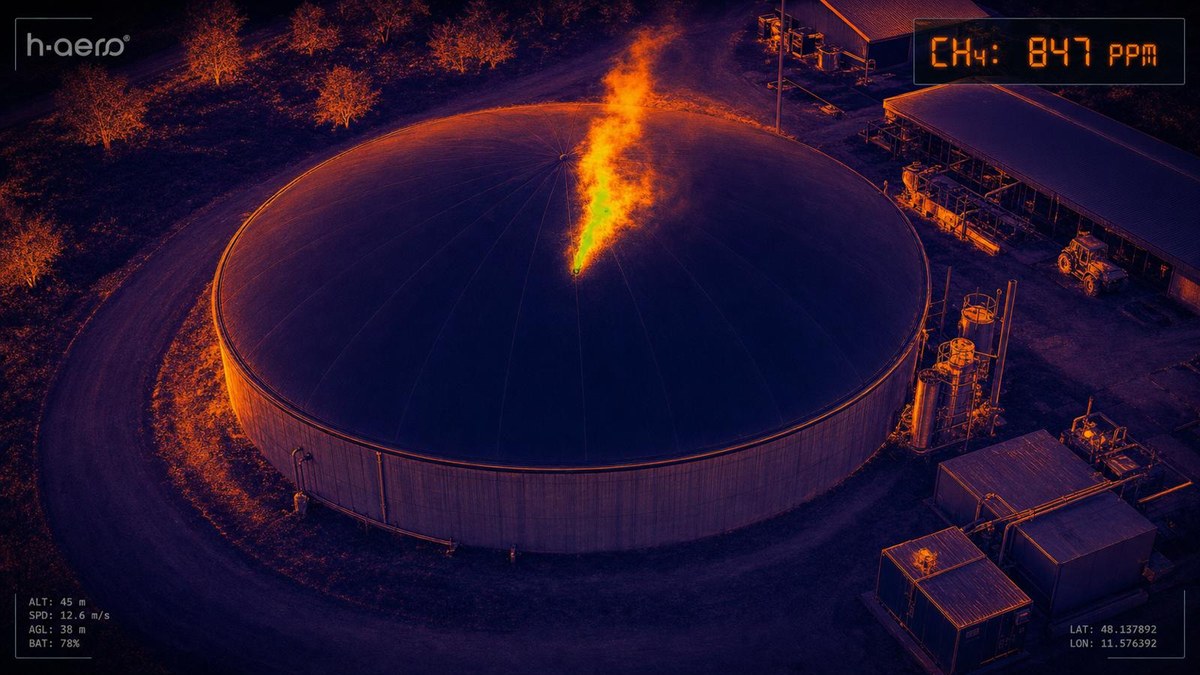
Hotspots, wildlife, leaks and early fire detection.
Bioacoustics, noise sources and leak localization.
Radiation and gas concentrations from the air.
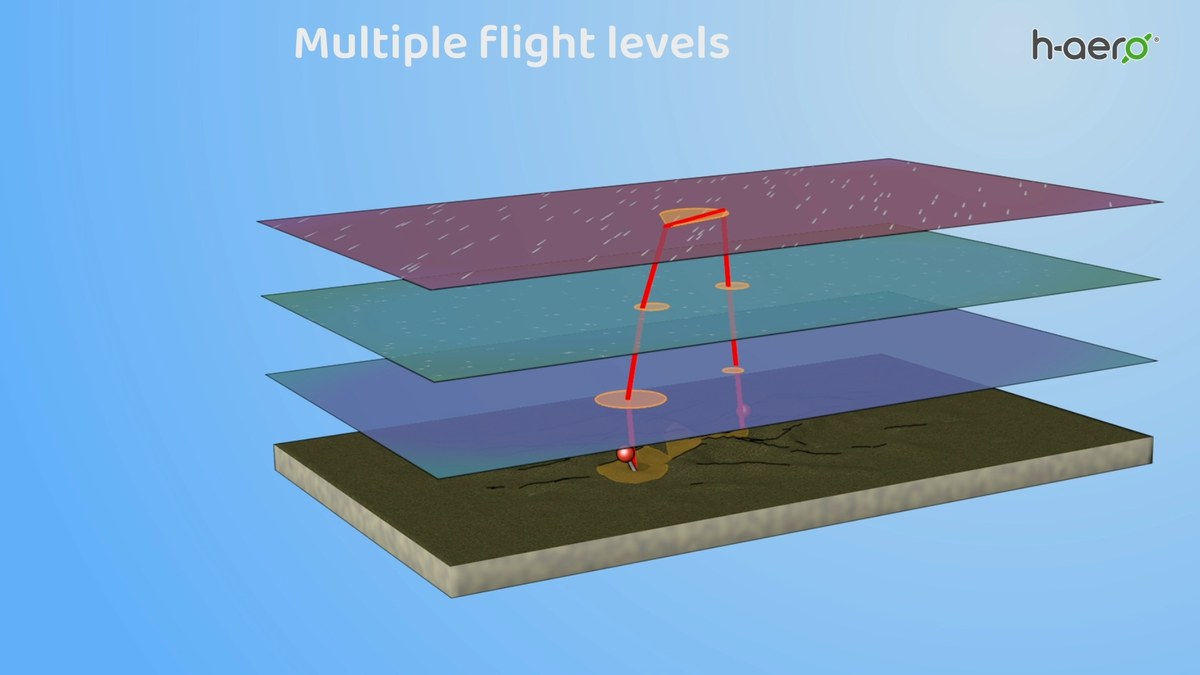
Combining multiple sensors for reliable, multi-layered data.
A seamless path — from low-noise capture to visualization.
Low-noise, downwash-free flight with the right sensors — high-resolution and georeferenced.
AI-assisted analysis and post-processing of the sensor data.
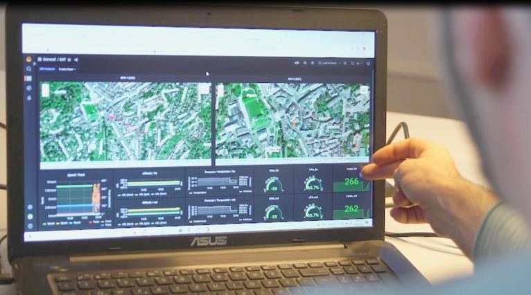
Maps and dashboards — in near real time or as post-processing.
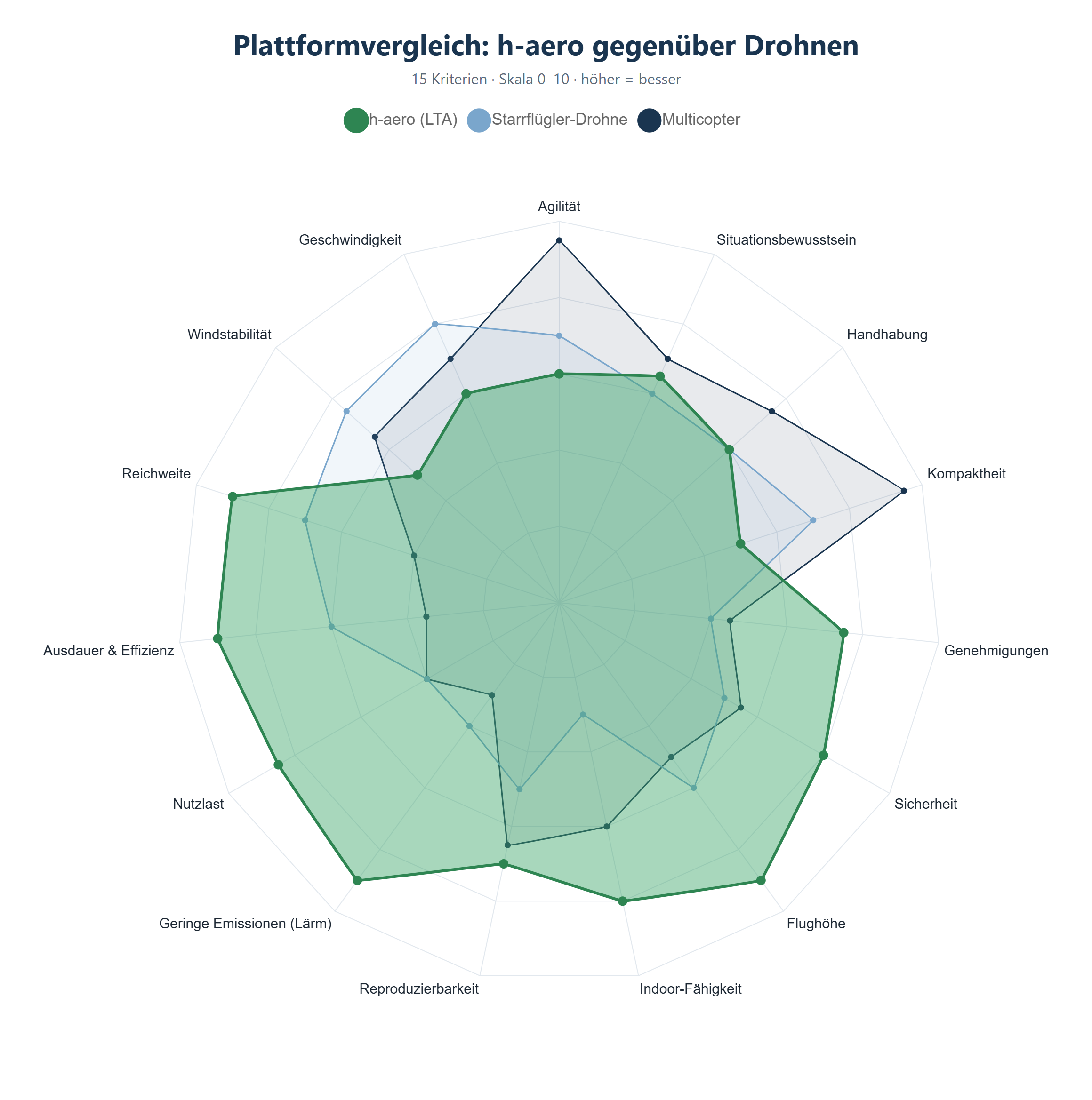
In a direct comparison across 15 criteria, h-aero plays to its strengths in endurance, range, payload, low emissions, flight altitude and safety — while drones lead mainly in agility, compactness and speed.
Applications
One low-noise, habitat-friendly platform — monitoring as a service across three application fields.
Forest condition, damage and early fire detection — gently captured from the air.
Learn more →Greenhouse-gas monitoring and impact verification of peatland restoration.
Learn more →Non-invasive species and biodiversity monitoring with AI analysis.
Learn more →Partnership
We don't start with a large investment, but with a demonstration on a concrete use case. We build on that together — fairly financed.
We show on a concrete use case what h-aero can already do today.
Together we close the technical “deltas” for your application.
If the solution proves itself, we run the task on a lasting basis.
We cover the initial efforts of demonstration and PoC as far as possible through public funding — keeping the entry lean for our partners.
Investments our partners help carry at the start are credited back on a pro-rata basis as the collaboration continues. So the joint start pays off — and you learn alongside us.
Trust & references

h-aero is active in the EU project FORWARDS (Horizon Europe) with its HALO-FARM sub-project and holds flight-ascent permits for operations over forest and natural areas.